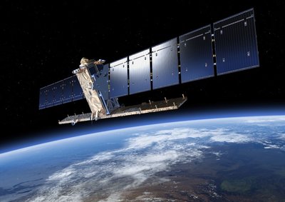
With an ever-growing population, the land used for agricultural activity must become more productive. This means continuing to adapt with the technological changes that a modern world brings. One of those critical pieces of innovation provides support while being far away from any farmland: Satellites.
With increasingly bigger farms and decreasing staff, the ability to remotely monitor all aspects of the respective land via GPS tracking applications is crucial and helps to avoid a logistical nightmare. While Unmaned Aerial Vehicles (UAV) previously filled this role, satellites are starting to take the lead with massive improvements to both the frequency of imaging and resolution. This provides farmers with high definition imaging of their land to protect yield or react to crop stress in a timely manner. Additionally, GPS tracking doesn’t require more than a software to get actively involved in precision crop management.
For any farmer growing crops, diseases and water logging are constant fears. Analysing high-resolution satellite images helps to detect both threats earlier than standard observation on the ground. This same imaging technology can also detect soil areas that are over or undersaturated and countermeasures therefore initiated before it is too late. Beyond arable crops, satellites also offer useful applications for livestock farming as well. Satellite imaging programs can ensure that entire agricultural operations are within government regulations or help to accurately plan future farm expansions. An outstanding use for satellite imaging directly links to profits: estimating crop yields. Receiving accurate estimations for each season’s yields, allows farmers to efficiently plan variations in income and expenses.
Technology as a safe haven
Regardless of the location on the planet, satellite imaging providers can help farms operate more efficiently. Additionally, satellite communication networks offer superior coverage and reliability. This is crucial in the event of extreme weather, emergency, or to extend connectivity to remote locations.
Chris Harry-Thomas, Director of Agritech Strategy at Inmarsat Enterprise said: “As agriculture expands into new and more remote land, terrestrial connectivity becomes increasingly limited. […] Satellite communication therefore has an integral role to play as it enables cutting edge technologies to be accessed in the most remote areas of the planet, equipping farms with networks of automated devices and sensors to protect workers.”
Even though farming is becoming one of the most technologically involved industries, 1.3 billion farmers worldwide still need to get their hands dirty. A study conducted by the International Labour Organisation estimates that at least 170,000 agricultural workers perish each year. Millions more suffer injuries from accidents with machinery or negative long-term health effects from exposure to agrochemicals and pesticides. Despite industry efforts to improve health and safety in agriculture, mortality rates remained high in the last decade. In other sectors, fatal accident rates have generally decreased. The farm of the future will leverage innovative technologies like satellites to lower risks for the workforce, tackle environmental changes and help identify efficiency gains or cost saving opportunities. According to an independent study commissioned by Inmarsat, those are the primary motivations of agritech companies for developing IoT solutions.